Visibility Alerts and Filtered Sun: Navigating Portland’s Mild Friday Break
Morning Fog Challenges Commuters
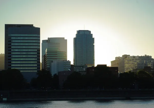
Portland residents waking up this Friday morning are met with a thick layer of winter fog that has settled low over the Willamette River and across the city skyline. The National Weather Service has issued a caution for early commuters, noting that damp air and mist have significantly reduced visibility across the metro area. Drivers on I-5, I-84, and Highway 26 should be prepared for pockets of dense fog, especially near river crossings and in low-lying neighborhoods. With temperatures hovering in the low 40s and winds remaining light, the fog is expected to persist through the mid-morning hours before gradual improvement begins.
An Afternoon of Filtered Sunshine
Once the morning mist clears, Portlanders can look forward to a brief but welcome departure from the standard February chill. As the clouds thin toward midday, filtered sunshine is expected to take over, pushing temperatures to a mild daytime high near 60 degrees. This unseasonable warmth offers a pleasant window for outdoor activities, providing a rare bright break in the mid-winter calendar. The air will feel notably mild for early February, and light winds will contribute to a calm, spring-like atmosphere through the mid-afternoon hours.
- Morning Temperatures: Low 40s with persistent fog and mist.
- Afternoon High: Reaching 58°F to 60°F under filtered sun.
- Evening Conditions: Increasing cloud cover with a low of 42°F.
- Travel Alerts: Fog and reduced visibility on major highways through late morning.
Clouds Return for the Evening
The clear window is expected to be short-lived as the region prepares for the return of more traditional Pacific Northwest weather. By Friday evening, clouds will begin to gather again, blanketing the city and bringing a slight 20% chance of light rain overnight. While no significant rainfall is predicted for the remainder of today, this shift in the atmosphere signals a change for the upcoming weekend. The temporary ridge of high pressure will give way to a series of systems starting late Saturday, which are forecast to bring steadier rain and cooler conditions back to the Willamette Valley.
Weekend Outlook
Looking ahead to the rest of the weekend, the mild temperatures enjoyed today will slowly start to retreat. While Saturday will begin relatively dry, rain chances are slated to increase by tomorrow evening, leading into a damp and gray Sunday. For today, however, the primary focus remains on the morning visibility challenges and the unseasonable warmth of the afternoon. Residents are encouraged to take advantage of the dry conditions before the umbrellas are needed once again for the start of the next work week.