Snow chances in Portland next week hinge on cold air timing, moisture, and overnight temperatures
What “snow next week” means in practical terms
With mid-February approaching, the question of whether Portland could see snow next week is less about whether cold air exists somewhere in the region and more about whether three ingredients align over the metro area at the same time: sufficiently cold air near the surface, enough moisture, and precipitation arriving during the coldest part of the day.
In Portland, lowland snow is typically most likely when temperatures hover near freezing overnight or early morning while precipitation is still falling. Even then, whether snow sticks depends heavily on ground temperatures, precipitation intensity, and small variations in elevation across the city and suburbs.
Current signals: mild pattern, with uncertainty beyond the seven-day window
Recent local forecast messaging has emphasized a relatively mild, dry-to-partly-dry pattern in the near term, with temperatures projected to run well above seasonal norms at times and lowland snow described as unlikely in the first half of February. Under that setup, precipitation that does arrive tends to fall as rain at lower elevations, while snow is limited to higher terrain.
At the same time, forecast confidence typically drops as models push beyond roughly a week. A shift to a cooler, more showery regime later in the period would increase the odds of lower snow levels, but it would not automatically translate into accumulating snow in Portland.
Why snow can still happen in a generally mild week
Portland’s snow threats often come from narrow windows when colder air drains into the Willamette Valley while a weak disturbance brings light precipitation. These events can produce brief bursts of wet snow, graupel, or a rain-snow mix—sometimes during late-night or early-morning hours—without a prolonged cold spell.
Small temperature differences matter. A forecast of 34–36°F with rain can become a slushy accumulation if precipitation rates increase and temperatures dip 1–2 degrees, particularly in neighborhoods above the valley floor or farther from the urban core.
Key indicators to watch over the next several days
Overnight lows: repeated lows near 32°F raise the chance that any precipitation falls as snow or freezes on contact.
Snow levels: a drop toward the valley floor is necessary for widespread low-elevation snow, but timing is critical.
East winds and cold air drainage: these can hold surface temperatures down, especially east of the metro area and near the Gorge.
Precipitation timing: nighttime precipitation increases the odds of snow compared with daytime showers under the same air mass.
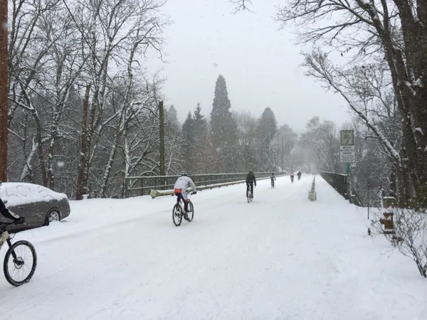
For Portland, the most impactful winter weather is often not heavy snowfall but brief periods of snow, freezing rain, or refreezing that quickly affect bridges, hills, and untreated streets.
Preparedness: what changes if a winter-weather signal strengthens
If forecast guidance trends colder and wetter at the same time, travel impacts can develop quickly. In Portland, bridges and overpasses can become slick before surface streets, and conditions can vary widely by elevation. City transportation officials maintain a Winter Weather Center to track plow activity and prioritize emergency routes during events.
For now, the most defensible conclusion is that widespread accumulating snow in Portland next week is not a leading outcome, but the probability is not zero and could change with the timing of colder air and the arrival of precipitation.