Bundle Up, Rose City: Arctic Air and Frosty Streets Define Today’s Forecast
Rose City Shivers Under Canadian Cold Snap
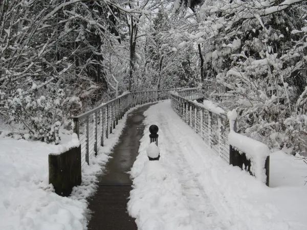
Portland residents are waking up to some of the lowest temperatures of the season as a significant cold snap settles over the Willamette Valley. Following a blast of arctic air moving down from Canada, the National Weather Service (NWS) has issued a Cold Weather Advisory for the region, which remains in effect for today, Sunday, January 25, 2026. While the skies are expected to remain mostly overcast throughout the day, the primary concern for locals is the biting temperature that has the city reaching for its heaviest winter gear.
Morning: A Frosty and Frigid Start
The morning hours will be the coldest of the day, requiring extra time for those heading outdoors. As of the early morning hours, temperatures in the Portland metro area have already dipped to 25°F. With humidity levels reaching near 100%, widespread frost is expected across the region. This combination is likely to create slick conditions on overpasses, bridges, and untreated side streets. Although the sky may show periodic breaks in the clouds early on, the "feels like" temperature is projected to stay in the low 20s until well after sunrise. Commuters and early-morning walkers are urged to be cautious of icy patches and ensure that outdoor pets are properly sheltered from the freezing conditions.
Afternoon: Persistent Clouds and Limited Warming
As the day progresses, Portland will see a shift toward more consistent cloud cover. The afternoon high is forecasted to reach a modest 42°F, which sits well below the historical average for late January. While the sun may attempt to peek through the overcast layers, the cooling effect of the northern air mass will keep the atmosphere feeling crisp and sharp. There is a slight 10% chance of precipitation during the day, which could manifest as a stray flurry or light freezing drizzle in higher elevations, though no significant accumulation is expected at the valley floor. Average humidity will settle around 73% by mid-afternoon.
Evening: The Re-freeze and Overnight Lows
The mercury will begin a sharp descent once again immediately following sunset. Evening predictions suggest that temperatures will plunge back toward the mid-20s, with an overnight low of 25°F anticipated. The NWS warns that the cold air will remain settled in the area through Monday morning. Because of the lingering moisture and high humidity from earlier in the day, the risk of black ice formation remains high for Sunday night as surfaces drop back below the freezing mark.
Weather Alerts and Safety Notices
As the lead editor for portland.news, we want to highlight the following active notices for our community:
- Cold Weather Advisory: This advisory covers the Willamette Valley and Southwest Washington. Residents are advised to check on vulnerable neighbors and protect outdoor pipes from freezing.
- Shelter Information: Multnomah County has made year-round and overnight shelters available. While the specific "emergency" thresholds for some additional temporary sites are monitored closely, standard winter shelters are open for those seeking warmth.
- Travel Caution: Drivers should use caution on elevated surfaces where frost may linger throughout the afternoon despite the marginal rise in temperature.